29 August, 2006

Pull List - Week of August 30th

DC Comics
52 #17
Action Comics #842 (Teen Titans crossover)
Justice #7 (Love Alex Ross)
Teen Titans #38 (DUH!!)
Trials of Shazam #1 (Captain Marvel was the first superhero I ever read)
Uncle Sam and the Freedom Fighters #2 (OK so far.  I'm curious to see where they go with this team)

IDW
CSI Dying in the Gutters #1 (Curious to see what they do to Rich Johnston)

23 August, 2006

Pull List - Week of August 23

A sure sign I am getting caught up with everything... I'm back to posting my pull list for the week.

52 #16
Birds of Prey #97
Blue Beetle #6
Flash: The Fastest Man Alive #3
Justice League of America #1
Wonder Woman #2

21 August, 2006

The Beast Boy & Raven Comic Book Watch - 8/21/06

Just a quick BBRCBW entry to bring us up to date. Yeah, I'm still swamped with stuff. But here are a couple more from recent issues that I've found.

52 #8 ("History of the DC Universe, pt. 7")
Story by Dan Jurgens, Inks by Andy Lanning

Neither Gar nor Raven have appeared at all in 52 since the first week, but they do seem to be periodically popping up in the back-up feature.

1) In Part 7 of History of the DC Universe, the pre-OYL team of Titans are mentioned with an appropriate illustration.


Secret Six #3
Story by Gail Simone, Pencils by Brad Walker, Inks by Jimmy Palmiotti

1) As a lead-in to the crossover next issue, the last page of Secret Six #3 has the team of anti-heroes encounter the Doom Patrol. Gar is there in the form of a goose.


Note Mento way in the background.

*****

I don't think there are any more images I've missed from the past few months, but I could be wrong. I'm still about a mnnth and a half behind on my comics, though. But if I find anything else of interest, you can be sure I'll post it here.

A few release notes: As most everyone knows, Teen Titans #38 was pushed back to the end of August. Its current release date is August 30, next week. There should be at least a few images in there to post. Gar and the Doom Patrol will be encountering the Secret Six in Secret Six #4, which should come out in mid-September. At the end of September will be the release of 52 #21, which will definetely have one of the Gar-led Titans teams in it; that may be the only glimpse we'll ever get of Gar and Raven on the same team during the One Year (BLAH!). As for way on the horizon, the release of Raven #1 seems to have been pushed back, possibly until early 2007. No idea why, although perhaps DC wants to make certain the mini series is substantially written before committing to a release date (according to Marv Wolfman's blog, the script for #1 was handed in about a month ago and #2 was still being written). As for where Gar will actually end up... no news. Sadly, its looking like he'll be in limbo for quite some time to come.

19 August, 2006

Trip Reports Delayed

Work has really piled up this last week and a half, and I've got some family obligations today and tomorrow.  Thus, I probably won't be getting to the rest of my trip report this weekend.  Hopefully next.

For the Garfield Logan fans out there, I do have one entry to add to the BBRCBW: Gar appears on the last page of Secret Six #3.  If I have the time on Sunday I'll post the image.  Its not much, but I suppose its something.

*sigh*

I hate real life.  Want to win the lottery.  Want to not have Real Life crap to deal with.

16 August, 2006

UB313... Planet!

The International Astronomical Union will be issueing a formal definition of the term "Planet" next week... and that definition will mean UB313 (which has not been formally named yet) will recieve an official designation as a "Planet".

From the wire services, here's the formal definition:

"A planet is a celestial body that (a) has sufficient mass for its self-gravity to overcome rigid-body forces so that it assumes a hydrostatic equilibrium (nearly round) shape, and (b) is in orbit around a star, and is neither a star nor a satellite of a planet."

In other words, if the object is large enough that its own gravity forces it into a ball, and is in orbit around a star but not another planet, then it is considered a planet. This leaves aside any definition of planet based on an arbitrary ruling of size or mass. It also opens the door for many more objects to become (re)classified as "planets", instead of "small solar system objects" (as asteroids, or "minor planets", will now be called). Indeed, the definition above not only lets UB313 into the Planet Club, but also main-belt asteroid Ceres. And pending better observations of such objects as Sedna, Quaoar, and other outer-solar system (Kuiper Belt) objects, the number of worlds (re)classified as Planets might go up even more.

But wait, it gets even stranger. In a footnote to the planetary definition, we find this:

"For two or more objects comprising a multiple-object system, the primary object is designated a planet if it independently satisfies the conditions above. A secondary object satisfying these conditions is also designated a planet if the system barycenter [center of mass] resides outside the primary. Secondary objects not satisfying these criteria are 'satellites."

This means that if the center of mass of a planet-satellite system resides outside of the primary object, then both objects are considered a "double planet", and each member of the duo are considered planets. In our solar system, there is only one planetary system that fits that definition: Pluto-Charon. So while Pluto has been considered a planet since its discovery, its satellite Charon is about to get the same definition because Charon is sufficiently massive and orbits far enough away that the center of mass lies in space between the two worlds rather than below Pluto's surface (in contrast, the center of mass for our own Earth-Moon system lies just below the surface of the Earth). Effectively, they will collectively be considered a "double planet".

The above definitions are not formal yet; they have to be voted on by the IAU body. But that vote is set for next week. If the definition passes, then our solar system will have 12 objects officially classified as Planet, with probably more yet to come.

For anyone who is interested, here's a quick summary:

What's A Planet? (Sky and Telescope)

EDIT: Here's what Micheal E. Brown (one of UB313's co-discoverers) has to say about the proposed IAU definition:

IAU Proposal

According to him, the IAU definition would mean there are currently 53 planets in our solar system with more yet to come. He refers to it as the "Leave No Ice Ball Behind!" definition.

Well, this is going to get heated.

13 August, 2006

Doctor Wbo Second Season on SciFi!

It has now been confirmed that the new Doctor Who, season 2 will start running on the SciFi Channel this fall.  "The Christmas Invasion" will make its US debut on September 29, with "New Earth" in the week following.  SciFi Channel was apparently very satisfied with the ratings on the first season (even though they initially rejected the show!), and are looking forward to continuing that run with the second.  If all goes well, maybe we'll even get next year's season soon after it broadcasts in the UK next spring.

Trip Report, Day Six

(Friday, July 21, 2006)

Currently I Am In: East Glacier, Montana

I didn’t take any pictures today. I probably should have, but the occasion just never came.

We got up early and left Chinook. Today for the first time in several days, we had a specific destination in mind that we MUST have gotten to by the end of the day. Namely, Glacier Lodge in East Glacier, Montana. Three night reservation in an historic, old style hotel. Once there, no more extensive driving until its time to go home. Although considering its me we’re talking about, chances are I’ll be doing s fair amount of driving exploring the area.

Anyway, the drive from Chinook to East Glacier was mostly uneventful. This area is known as the Montana Hi Line region, named because it runs along the Burlington Northern railway line (the northern most of the railways linking the east coast with the west), which generally parallels US 2 across most of Northern Montana. This is high plains country, almost entirely treeless, with surprisingly few hills or rocky areas. Primarily agricultural, with wheat being the main cash crop. It is not uncommon to find areas where all you can see, right up to the horizon, is a flat sea of waving wheat. A few fair sized towns were driven through: Havre, Shelby, and Cut Bank being the primary ones. It was only until we got west of Cut Bank did we see any real hint of the Rockies.

Passed through the town of Browning. Very, very depressing place. Browning is on the Blackfoot Reservation and serves as the tribal headquarters. Unfortunately, the town looks poorer than anything I saw along the way. Dirty, dilapidated, very, very depressed. It’s a pity, because the town is almost at the base of Rockies and is along the main route to Glacier National Park main entrance. The town should be a tourist mecca, much like Cody, Wyoming is on the way to Yellowstone. But it isn’t. It’s a rundown hovel with high unemployment and low expectations. And the few businesses that seem interested in trying to turn that around... have a very difficult time of it because the rest of the town just doesn’t seem to care. There are people that seem to want to improve things - while exploring, I found a development of newly made, well-kept up suburban-style housing - but until that downtown district gets rebuilt and revitalized, I don’t see anyone wanting to stop and spend any time in the town. Seriously, this is one town where I think building a bypass around it and having the businesses start afresh outside of town might not be a bad idea.

Arrived in East Glacier and checked in at the Glacier Lodge. Nice, big, interior main lodge. Rooms are OK, though; a little more rustic than I would have liked, but for a few days its absolutely fine.

Trip Report, Day Five

(Thursday, July 20, 2006)

Currently I Am In: Chinook, Montana

This morning started with a clap of thunder.

The fact that bad weather was moving in seems to have caught everyone by surprise. Last night’s weather report said that there was only a very slight chance of rain, and that the morning would start out partly cloudy with rain only possible toward the mid day. Well, morning started out with rain, rain, thunder, lightning, and more rain.


So much for the weather reports.

First stop today was another historic fort site, Fort Buford State Historical Site. This one is just outside of Williston, at the confluence of the Missouri and Yellowstone rivers. This was one of the more important military outposts in the area, right up until the early part of the 20th Century. This site at least had many artifacts original to the fort, including the original iron stove, which the area re-enactors were want to use whenever they camped out there (like, apparently, they were scheduled to do that weekend). There are only four structures left on the site, one of which was a reproduction and another had only its skeleton still standing.


Fort Buford officer's quarters.


It was mostly raining at this time, so we didn’t go out to the farther structures and only went to two larger buildings (which had indoor tours). The first building was the fort’s Officer’s Quarters, the second was the Enlisted Barracks. The boys liked the barracks, because they got to climb in the bunk beds.

I did see something rather humorous bordering the site. Right next to the Fort grounds are some private residences. One of the site’s neighbors has actually installed a pop machine in front of the house, to cater to the site’s visitors. Ah, the American Profit Motive in action.

A half mile away is the Missouri and Yellowstone Confluence Interpretive Center, operated by the North Dakota Historical Society. Its basically a history museum for the area, showing what life has been like in that corner of the Dakotas for the last 150 years. Didn’t get any pictures of the inside. I took one of the confluence of the two rivers, but the picture proved too dark to post.

Next up would have been Fort Union National Historical Site, which was only a few miles away. But by that time the rain had really kicked up, and I think I just decided I’d seen enough fort sites for the time being. So we got back on US 2 and headed west.

As anyone who has done any traveling on US roads has probably noticed, mile posts generally run from West to East or from South to North. This means that if you are driving on a road that is heading either West or South, the milepost numbers will be decreasing by each mile, effectively giving you an idea as to how far before the road either ends or you reach the next stateline (if you go in the opposite direction, the numbers will be ascending).

Upon entering Montana on US 2, the first milepost you find says “664". That means it is 664 miles from that point to the border of the next state (Idaho).

Montana is a BIG state.

US 2 through North-Eastern Montana is mostly a two-laned highway, but it looks like that is about to change. Like North Dakota has already done with US 2 across most of its length, Montana is in the process of turning the route from a 2-laned road to a 4-laned highway. Work is already underway around Glasgow to expand the road, and there are signs up and down the road (mostly in front of businesses) urging people to support “4 for 2" (4 lanes for US 2). From what I can see along the construction sites, the plan is to do the same kind of bypassing North Dakota has already done. Which means once more, if you want to go through a small town, you will soon have to get off the main road. I know the reason why a lot of these businesses are supporting this move, but I have to wonder how supportive they’ll be when the bypasses are put in and business starts moving away from the central districts they are now.

Stopped in a little town called Dodson, Montana. By this time the weather had improved tremendously. Nice little picturesque quasi-historic hotel there; if it weren’t for the fact that I thought it was too early in the day to settle down, I might have looked to see if there was a room available. Ahh, maybe the next time I pass this way.


Finally arrived in the town of Chinook, Montana. This place really surprised me. Going through Montana today, most of the towns we encountered were dusty places, many of them seemingly (and sadly) in various states of deferred maintenance. Many of these towns were on the various Reservations we encountered along the way, but not all. And even the better off towns seemed a little on the deserted and primitive side. But not Chinook. Paved streets, side walks in even the residential neighborhoods, well-kept houses with spacious lawns, an active downtown district with no boarded-up buildings... you have to wonder what it is that this town is doing that the others aren’t. It probably helps matters that Chinook is a county seat, but none of the other Montana county seat towns we’ve encountered today (Malta, Glasgow, Wolf's Point) seem as well kept-up as this town. The place impressed me enough that we’ve gotten a hotel room at the Chinook Motor Inn, and are staying the night.

Trip Report, Day Four

(Wednesday, July 19, 2006)

Currently I Am In: Minot, North Dakota

Ugh. Internet access problems. My wireless card is fried, and there’s no local dial up access number here. Which is why things didn’t get posted last night. It may be a few days before I can post on my blog. There’s a Best Buy down the street from this hotel, so maybe I’ll go in and buy a new WiFi card.

*****

Currently I Am In: Williston, North Dakota

Ended up not buying one. I was so concerned about getting things together and keeping the kids from killing one another that I completely forgot about it and drove right past the Best Buy. And I don’t think there’s one in this town, although chances are there’s someplace in this town where I can pick up a WiFi card. But perhaps I’ll just wait until I get to the Glacier National Park area before contemplating that. So for the moment, probably no updates to the blog until I can get to someplace with decent access.

Oh, and another thing. Images may be few for the time being. Right now I’m using the camera feature on my cellphone. However, I apparently didn’t pack the hot sync cable, so I can’t download the pictures to my laptop. I was planning on getting around that by emailing them to myself from off the phone, but I’ve now discovered that Sprint’s claim of coast to coast internet access for my cell doesn’t seem to apply to western North Dakota. I can call in and out, but no text messaging, no picture mail, no internet access. Blah. Looks like Glacier is going to be my next, best option. There’s a good chance I’ll post the report, and then at some later time post the images.

And in speaking of items not packed, I discovered today that I left all my Jazz CDs at home. I’ve got a bunch of the Classical CDs I’d intended to bring with me, so I’m not entirely without my music. But it does make things annoying.

*****

Touristy things today.

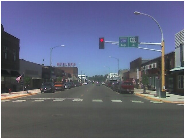
First off, we headed south from Minot to Washburn, ND and the Lewis & Clark Interpretive Center. This is a museum to commemorate the bicentennial of the Lewis and Clark/Corp of Discovery expedition of 1802-1806. It basically offered an overview of the expedition, of the world of the Native Americans at the time, and of early 19th Century frontier life in general. It’s a nice museum, but nearly everything in it are reproductions and aren’t even from the time period in question. They have only one actual artifact from the expedition, and it’s a small piece of one of the books that were brought along by one of the less well known expedition members. In that view, the museum is somewhat disappointing. Still, they provide a decent amount of introductory information and some interesting exhibits. The most impressive of the latter is a dug out canoe toward the back of the exhibit area.


This canoe was carved out of one single log, using only the kind of tools people at the time had. The canoe shown here is about the size of the ones Lewis and Clark used.

Outside, the boys encountered some horses from the horsefarm next door. They desperately wanted to ride them, but for obvious reasons that wasn't going to happen.


After the Lewis and Clark Interpretive Center, we headed a couple miles over to Fort Mandan State Historical Site. This is a reproduction of the original fort that the Corp of Discovery erected for the winter of 1803/04. Unfortunately, it is not on the site of the original fort; that site is about ten miles downstream, and sadly is now underwater due to the Garrison Dam. This version of the fort was constructed in the 1970s based on the original plans, and is said to be “98% Accurate” (The main discrepancy is that the walls are apparently three feet too short). The boys loved this place, and wanted to climb everything. They also pestered the tour guide to let them in some of the rooms, which the tour guide happily obliged.


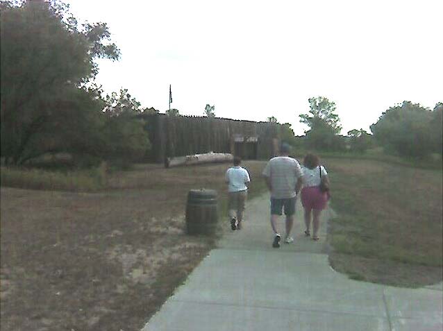
The path to Fort Mandan.


Missouri River from Fort Mandan.


Next up was the site of Fort Clark State Historical Site, which was nearby. Not much there except an open field, a path, and some markers. This was a Fur Trading Post in the middle of the 19th Century, adjacent to one of the larger Mandan settlements. It is notable in history because it was from here that a smallpox epidemic erupted in the early 1830s, brought by the steamboat St. Peter. This epidemic wiped out about 90% of the Mandans in very short order, and eventually led to the abandonment of the site.


(NOTE: I could have sworn I took more pictures than this of the site, but this is all I could find on my camera.)

After that, we visited Knife River Indian Villages National Historical Site. This was the site of one of the largest Native American settlements west of the Mississippi; by some estimates, as many as 25,000 people lived there or in close proximity around the year 1800, making it larger than most American cities at the time. On the site is a reproduction of an Earth House, one of the wood and dirt structures the Mandans used to live in, about 20 per structure. Nearby is a field filled with circular middens outlining where such structures used to stand; at least 50 such outlines have been identified, and probably many, many more have long since been plowed over by the farmers in the area. A sad fate for what was once, for all practical purposes, a huge city.


Earth House interior.


Site of Mandan village. Some 50 middens (structure remains) are present in this field.


It should be noted that all four of the historical sites listed above are within a few miles of each other. One could very easily spend an afternoon (like we did) visiting all four with a minimum amount of travel in between. Indeed, we could have extended the historical sightseeing even more by visiting some the sites to some of the other Native American settlements in the area, but instead we elected to get back on the road and push west.

It took us about an hour from Knife River Indian Villages, but after a long drive on ND Rt. 200 and a shorter drive up a narrow dirt road, we eventually arrived at the Killdeer Battlefield Historical Site. Not much there except a memorial, a flag, and the gravestones of two US Cavalry soldiers who died there. Killdeer was one of those battles that they don’t like to talk about in school. Basically, the U.S. Cavalry came in and attacked a group of Sioux camped there, obstensibly to retaliate for a previous Sioux attack. However, the group they attacked had nothing to do with that previous attack, in fact did try to surrender, but were slaughtered anyway. Among the Sioux to escape the massacre was Sitting Bull; 12 years later, he would annihilate Gen. Custer and the 7th Cavalry at Little Big Horn.


Killdeer Battlefield site.


Soldiers graves at Killdeer.


We headed back to civilization (or what passed for it in North Dakota), and then headed back north toward U.S. Route 2.

I had originally intended to try to drop by Theodore Roosevelt National Park, but by the time we arrived in the area of the North Unit it was starting to get late and the boys were eager to find someplace for us to crash. So, we ended up just driving past the park entrance, and continued on toward Williston, ND. Got a hotel there, and are now staying the night.

Trip Report, Day Three

(Tuesday, July 18, 2006)

Currently I Am In: Minot, ND.

Well, mixed results on the tent. The boys slept well, but I didn’t. Part of it was just nervous energy. I wanted to sleep, but couldn’t get myself to. The floor probably didn’t help, either. It was only after I decided it was time to go to bed that I discovered there were some uncomfortable rocks beneath where we’d pitched. And they just happened to be directly underneath where I was supposed to sleep. Probably wouldn’t have made much difference, though; even with the blanket and sleeping bag underneath, the floor was just too hard for me to get any real comfort. Sigh. Time was, I could have gone to sleep anywhere - floor of a tent, floor of a cave, a smoothed area on exposed rock - no problem. But now, my back protests anytime I try. I hate getting old. But the boys did have a good time, and as I said, they at least slept well. Next time I try this, I guess I’ll have to cheat and use an air mattress.

Last night as it was getting dark, Martin kept busying himself by running back and forth between our campsite and the gravel path. In the morning, I discovered what it was he had been doing:


He said it was a rock path, to help people find the way to our camp. Don’t you just love six year olds?

Anyway, we packed up and left the camp ground. I was hoping to go into Bimidji that day and at least get a picture of Martin and Liam standing in front of the silly Paul Bunyan statue, but at the last moment I just decided to skip it. Can’t really say why, but I just decided to press ahead rather than go back So instead, we headed west on U.S. 2.

When we started out at Bimidji, the land was predominantly green and wooded. Plant life was abundant. But as you push west, the land changes. The green gives way to tan and beige. The trees start to disappear, and become generally smaller in stature. The spaces begin to open up; the horizon starts to become visible. And the dirt starts to take on a dusty, drier, more granular quality. Welcome to the High Plains of the United States, the beginning of The West. And more specifically, welcome to the Dakota Territory. And all of this within the space of about a hundred miles.

About 20 miles outside of Bimidji, the forest starts to give way to increasingly more farmland. Corn and wheat, by the look of things. But soon even that gives way, and before long the predominant crop seems to be cylindrical bales of hay. That’s a sure sign you’re entering cattle country, where livestock is the predominant crop.

We entered North Dakota at Grand Forks, but didn’t see much of the town. Instead, we drove through and continued west. I was rather disappointed to find that US 2 doesn’t seem to go through many towns anymore. Instead, it has in recent years been laid to go around even the smallest of gatherings. What used to be Route 2 is now, more often than not, just another street in town, with the highway itself bypassing a mile or so away. I guess someone has determined that, for traffic control purposes, its better to have the highway go around the towns so people don’t have to slow down. *sigh* But I <i>like</i> slowing down and going through the small towns.

Still, I think this measure is eventually going to backfire on them. Why? Well, one of the things that has really piqued my interest were the number of towns in northern North Dakota that looked like they have had a significant amount of new construction recently. At Rugby, new neighborhoods had gone up, with brand new homes and streets that look only recently paved. At Devil’s Lake, I didn’t see a single building that looked more than 10 years old (I’m sure they were there, I just didn’t see one), and the one busy intersection I saw reminded me quite heavily of any slice of suburbia you’re likely to find, complete with numerous fast food joints and chain stores. Similar observations can be made up and down the entire length of US 2 between Grand Forks and Minot: towns are growing, new construction is going up, and with it new businesses to serve those new customers.

And where are these new businesses setting up shop? Why, right on Route 2 outside of town, and not in the “main street business districts” that Route 2 used to go through. They set up shop along the highway because they know that’s where the customers are more likely to pass now. Only boring people like me think of taking the “old Route 2" turn-offs and actually drive through the town - most everyone else just breezes by doing 70. So with new businesses setting up, the center of activity for the towns have started to shift away from the old business districts, and move “outside” where the main road has now been laid. And once those business start to set up there, you can bet other construction will follow - more businesses, new homes, etc. So in a generation or two, I’ll bet that many of those towns will have grown to encompass the areas adjacent the highway. The day will come when Route 2 is once more going smack dab, which will undoubtably necessitate yet another round of highway projects to once more bypass.

Anyway, that’s my observation of the day.

After Grand Forks, the land starts to become hilly. In truth, I don’t think its any more hilly than Northern Wisconsin. But the difference is, Northern Wisconsin is covered with trees and other wildlife. North Dakota is not, and that makes the topography much more noticeable. The Wide Open Spaces are becoming even more Wide Open, with hardly anything more than tons of the ubiquitous hay rolls and the occasional farm house to break things up.


U.S. Route 2, about fifteen miles west of Devil's Lake, North Dakota


Pulled into Minot around 4:00pm, found a room, got pizza for the kids, and am preparing to crash. Got to make up for the sleep I didn’t get last night.

12 August, 2006

Trip Report, Day Two

(Monday, July 17, 2006)

Currently I Am In: Bimidji, MN.

We spent the day driving. Yeah, big surprise there.

Started the day by visiting an antiques mall, waved good-bye to Interstate 35, then proceeded “inland”. Drove around a rather large lake (Mille Lacs), had lunch in Garrison, MN, drove deeper into the northern forests of Minnesota, finally hit U.S. 2 in the town of Grand Rapids, MN - our principal route for the next several days - then headed west to Bimidji, MN, where we got a campsite at a KOA campground for the night. In a nutshell, that was the day.

I like small towns. Especially old ones. I like the way they look, the way they feel. I like it when they try to preserve as much of their history as they can, maintaining and preserving their older buildings instead of tearing them down for the faux suburbia look. I don’t know if I could live in one for any length of time, but I can visit, and occasionally take a stroll through them. This trip, with impatient kids in tow, I’m more likely to drive through them than actually take the time to explore. But that’s one of the reasons why I’m avoiding the interstate and taking the “backroads”.

Some pictures for today:

Garrison, MN. On the shores of the Mille Lacs. Martin pointed to this statue and said, “Oh! They have FISH here!”


Downtown Aitkin, MN. Wanted to explore here a little more, but boys were instant about moving on.


Martin and Liam at Big Sandy Lake, in the Savanna State Forest. We were passing by, and the boys wanted to get out for a good look.


Panoramic view of Big Sandy Lake. Series of shots taken from the rest area along Minnesota 65, Photoshopped together to form a panorama. You'll be seeing a lot of these kind of panorama scenes in the coming days.


The Mississippi River at Grand Rapids, MN. Image taken from my car whilst stopped for a red light. Not much, is it? You'd never think something barely more than a creek would amount to much.


I haven’t been camping in about 15 years. My wife has never been interested in it (her idea of “roughing it” is a hotel room without television), so I just haven’t really had the chance. But since she’s not on this trip (she’s got a trial to prepare for), and since the boys have been asking about going camping for some time, I thought we’d give it a try this time around. So, here is the result of this endeavor:


Don’t know how this is going to go tonight. We’ve got sleeping bags and an extra blanket. But so far, the boys are loving it. Oh well, we’ll see how this goes.

General Note

As a lot of you know, I'm back from my vacation. Sorry for dropping off the face of the world, but I ended up having internet connection
difficulties while on the road, difficulties which prevented me from
posting regularly. I did keep a somewhat rambling log on my laptop,
though. And over the next few days I hope to post it, along with
pictures. Please bear with me. And intertwined with all of this will
be some comics updates and various things of interest. Sit tight, and
please be patient; I'm working as fast as I can on this.